


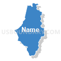
Caguas Municipio PUMA, Puerto Rico
About
Outline

Summary
| Unique Area Identifier | 194455 |
| Name | Caguas Municipio PUMA |
| State | Puerto Rico |
| Area (square miles) | 59.07 |
| Land Area (square miles) | 58.60 |
| Water Area (square miles) | 0.47 |
| % of Land Area | 99.20 |
| % of Water Area | 0.80 |
| Latitude of the Internal Point | 18.21110850 |
| Longtitude of the Internal Point | -66.05096430 |
Maps


Graphs
Select a template below for downloading or customizing gragh for Caguas Municipio PUMA, Puerto Rico


Neighbors
Neighoring Public Use Microdata Area (by Name) Neighboring Public Use Microdata Area on the Map
- Cayey, Cidra, Aguas Buenas & Aibonito Municipios--Carr 14-Carr 173 PUMA, PR
- Gurabo, San Lorenzo, Juncos & Las Piedras Municipios--Carr 30 PUMA, PR
- San Juan Municipio (Sur) PUMA, PR
- Trujillo Alto, Canóvanas, Loíza & Carolina (Sur) Municipios--Carr 852-Carr 185 PUMA, PR
Top 10 Neighboring County (by Population) Neighboring County on the Map
- San Juan Municipio, PR (395,326)
- Caguas Municipio, PR (142,893)
- Trujillo Alto Municipio, PR (74,842)
- Cayey Municipio, PR (48,119)
- Gurabo Municipio, PR (45,369)
- Cidra Municipio, PR (43,480)
- San Lorenzo Municipio, PR (41,058)
- Aguas Buenas Municipio, PR (28,659)
Top 10 Neighboring County Subdivision (by Population) Neighboring County Subdivision on the Map
- Cupey barrio, San Juan Municipio, PR (36,058)
- Cañaboncito barrio, Caguas Municipio, PR (27,464)
- Caguas barrio-pueblo, Caguas Municipio, PR (22,406)
- Caimito barrio, San Juan Municipio, PR (21,825)
- Tomás de Castro barrio, Caguas Municipio, PR (19,414)
- Bairoa barrio, Caguas Municipio, PR (19,258)
- Carraízo barrio, Trujillo Alto Municipio, PR (16,399)
- Turabo barrio, Caguas Municipio, PR (15,739)
- Cañabón barrio, Caguas Municipio, PR (11,310)
- Rincón barrio, Gurabo Municipio, PR (10,967)
Top 10 Neighboring Place (by Population) Neighboring Place on the Map
- Caguas zona urbana, PR (82,243)
- Hacienda San Jose comunidad, PR (3,531)
- Las Carolinas comunidad, PR (2,570)
- Los Prados comunidad, PR (2,129)
- Bayamón comunidad, PR (2,038)
- Parcelas Viejas Borinquen comunidad, PR (677)
- Bairoa La Vienticinco comunidad, PR (399)
- La Liga comunidad, PR (281)
- Los Panes comunidad, PR (267)
Top 10 Neighboring Unified School District (by Population) Neighboring Unified School District on the Map
Top 10 Neighboring State Legislative District Lower Chamber (by Population) Neighboring State Legislative District Lower Chamber on the Map
- State House District 31, PR (105,221)
- State House District 33, PR (105,215)
- State House District 29, PR (100,915)
- State House District 38, PR (95,031)
- State House District 5, PR (94,031)
- State House District 32, PR (93,102)
- State House District 34, PR (91,219)
Top 10 Neighboring State Legislative District Upper Chamber (by Population) Neighboring State Legislative District Upper Chamber on the Map
- State Senate District 6, PR (496,183)
- State Senate District 7, PR (491,573)
- State Senate District 8, PR (465,427)
- State Senate District 1, PR (435,070)
Top 10 Neighboring 111th Congressional District (by Population) Neighboring 111th Congressional District on the Map
Top 10 Neighboring Census Tract (by Population) Neighboring Census Tract on the Map
- Census Tract 2105.02, Gurabo Municipio, PR (12,515)
- Census Tract 2003.03, Caguas Municipio, PR (9,690)
- Census Tract 2601, Cayey Municipio, PR (9,431)
- Census Tract 100.42, San Juan Municipio, PR (8,817)
- Census Tract 101, San Juan Municipio, PR (7,892)
- Census Tract 603.02, Trujillo Alto Municipio, PR (7,832)
- Census Tract 102, San Juan Municipio, PR (7,505)
- Census Tract 2201, San Lorenzo Municipio, PR (7,452)
- Census Tract 2026.02, Caguas Municipio, PR (7,340)
- Census Tract 2024.02, Caguas Municipio, PR (7,328)
Top 10 Neighboring 5-Digit ZIP Code Tabulation Area (by Population) Neighboring 5-Digit ZIP Code Tabulation Area on the Map
- 00926, PR (108,862)
- 00725, PR (89,374)
- 00727, PR (58,382)
- 00736, PR (51,532)
- 00778, PR (45,429)
- 00754, PR (40,828)
- 00739, PR (39,678)
- 00703, PR (28,605)